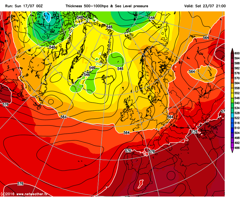
If you’ve been following the weather quite closely, then I’m sure you’ve heard about an upcoming pattern known as a “Spanish plume”. Well, one of these is coming our way this week so you can expect to see some hot and sunny weather, with the added risk of some thunderstorms too. It will only be a temporary feature though, so the heat will be limited for a short time, before cooler air moves in from the Atlantic again later on.
Today we will have quite a bit of sunshine around, though the north is currently being plagued by some low cloud off of the Irish Sea. I expect this to gradually clear through the morning, leaving most areas with a fine and pleasant day. Highs today will range from between 19-22°C in the north, to a very warm 24-27°C in the south.
Into Monday and we will start to see signs of the Spanish plume, as warmer and more humid air starts to be introduced from the south. Cloud amounts are expected to be rather variable, but where the sun comes out temperatures will rise fairly sharply. I expect highs in the north to range from 21-25°C in the north, to 26-29°C in the south, with some places potentially hitting 30°C (86°F) during th afternoon.
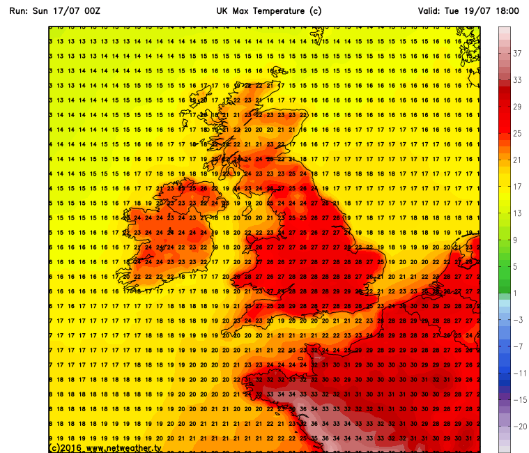
Tuesday will then see a splendid summer’s day, as the Spanish plume reaches it’s peak. This day will feature lots of hot sunshine for pretty much all areas in a light south-to south easterly wind. Locally it will feel hot or even very hot with temperatures in South East getting up to 32°C (90°F), perhaps even a touch higher in some places! Even further north in cities like Manchester and Leeds, temperatures still have a very good chance of hitting the magic 30°C.
However as we move into Tuesday night and the early hours of Wednesday, the humidity will start to rise quite sharply, allowing some thunderstorms to kick off in southern and central areas. These storms are expected to gradually track northwards, intensifying as they do so. Temperatures will also remain fairly high too, perhaps not really getting below 19-20°C for most areas of England and Wales, so it could be quite an unpleasant night for sleeping for some.
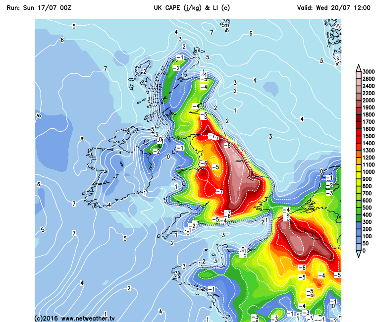
Wednesday will then see some big and widespread thunderstorms kicking off, mostly in the morning and afternoon. I expect these storms to develop around Wales and North West England during the morning, gradually moving northwards, before shifting to eastern areas in the afternoon, again gradually tracking northwards. Temperatures will also be lower on Wednesday, though given the high humidity, it will still feel very warm or even hot in the sunshine. Highs are expected to range from between 22-25°C in the north, to 27-30°C in the south.
Then as we move through Wednesday night and into Thursday, cooler air will start to move back in off of the Atlantic, so it will feel markedly fresher for most by this time (though the South East may just about hang on to the warmer air). Cloud amounts will be variable and some showers may develop through the day. Highs will be much lower, ranging from 18-21°C in the north, to 22-26°C in the south and east.
Looking at Friday and beyond, and the weather is actually looking fairly pleasant for a change. The models are hinting at the Azores High attempting to build through the country as we move into next weekend, potentially allowing us to enjoy some warm and dry weather during this time too. Of course, confidence cannot be nailed at this point, but I will keep you updated. Finally, I will leave you with this: